.
..
…
Recently, I walked the streets of Santa Barbara, a town where it is good to live if your daddy was rich and your mother good looking.

Photos are meant to be shared
.
..
…
Recently, I walked the streets of Santa Barbara, a town where it is good to live if your daddy was rich and your mother good looking.
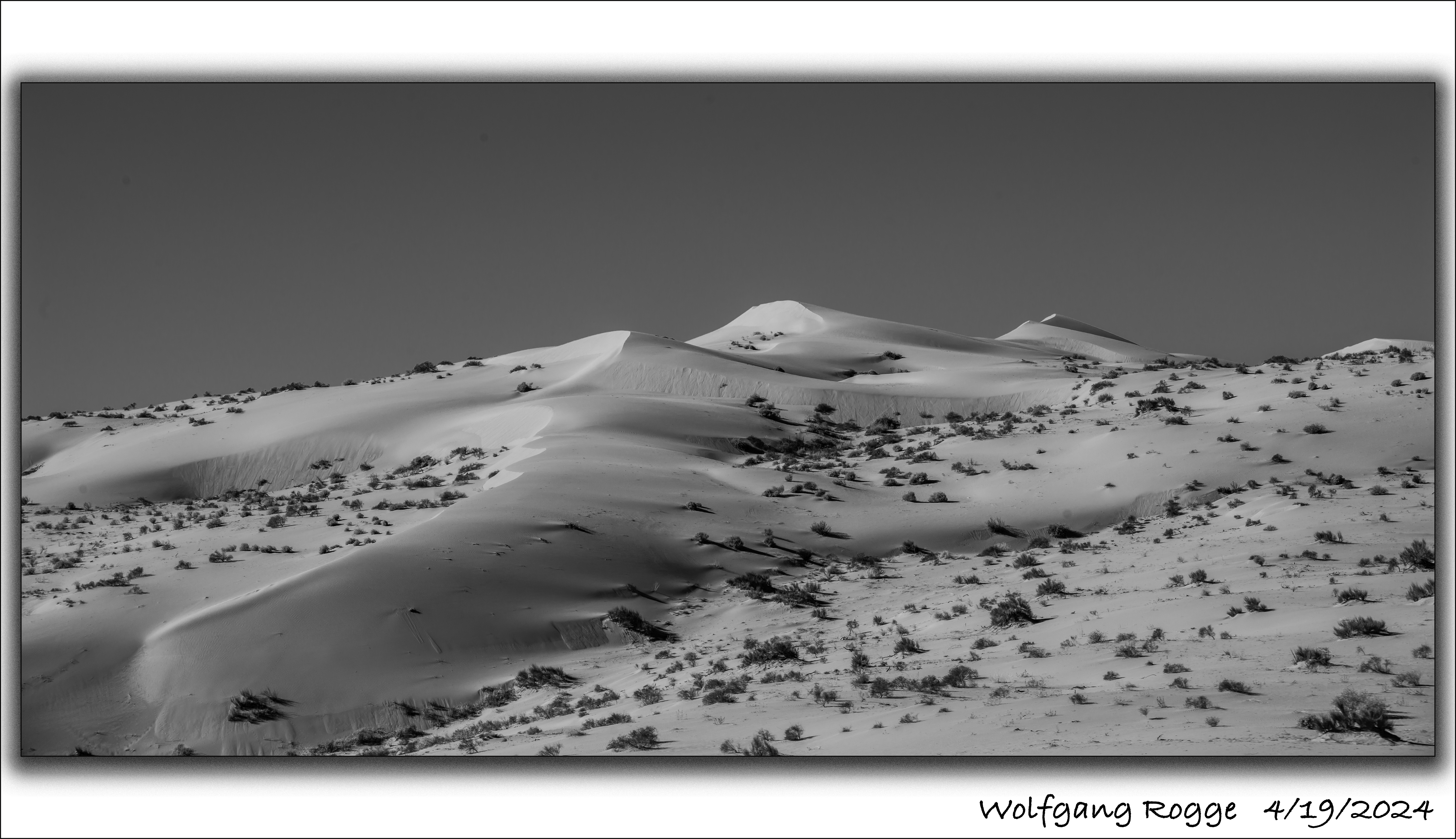
The Algodones Dunes are a large sand dune field (45 miles by 6 miles) in the southeastern portion of California, east of the present day Salton Sea (currently -236 ft below sea level). Typically, the Colorado River flows south to the Sea of Cortez (Gulf of California). But, once in a while, due to several reasons, the ancient Colorado River spilt into the present day Salton Sea area and a freshwater lake developed, called Lake Cahuilla. The last Lake Cahuilla covered much of the Imperial, Coachella, and Mexicali Valley, and occurred as late as 1450. The most popular theory suggests that the Algodones Dunes formed over thousands of years from the windblown beach sands of landlocked Lake Cahuilla, especially when it’s water slowly evaporated and the aeolian processes picked up the finer sediments in this forming arid environment.
Today, the Algodones Dunes is used by men and women who are in need of driving sand buggies around and around until all beer is spilt or the gasoline tank is empty. Luckily, some parts are closed off for sand buggies. The photo shown here is from the closed off area.
…
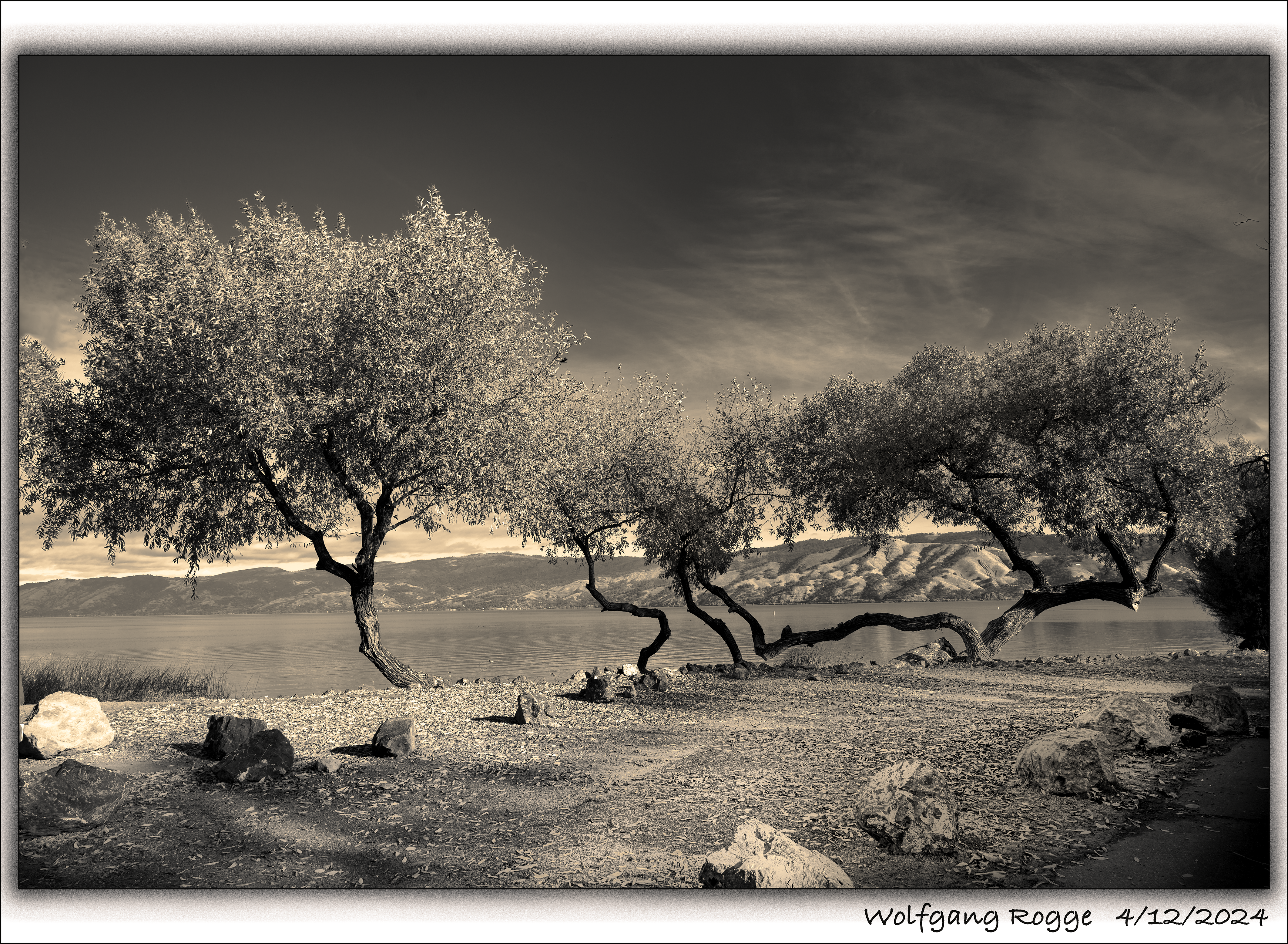
Lucky us that Clear Lake is not a National Park! So, it’s easy to get there, no Disney Type Environment. Just the largest freshwater lake in California, with 68 square miles of surface area. It has cool campgrounds along it’s shore. Here, a photos at my campsite, a while back.
…
(Gestern war ich noch schön…)
..
…
….
…..

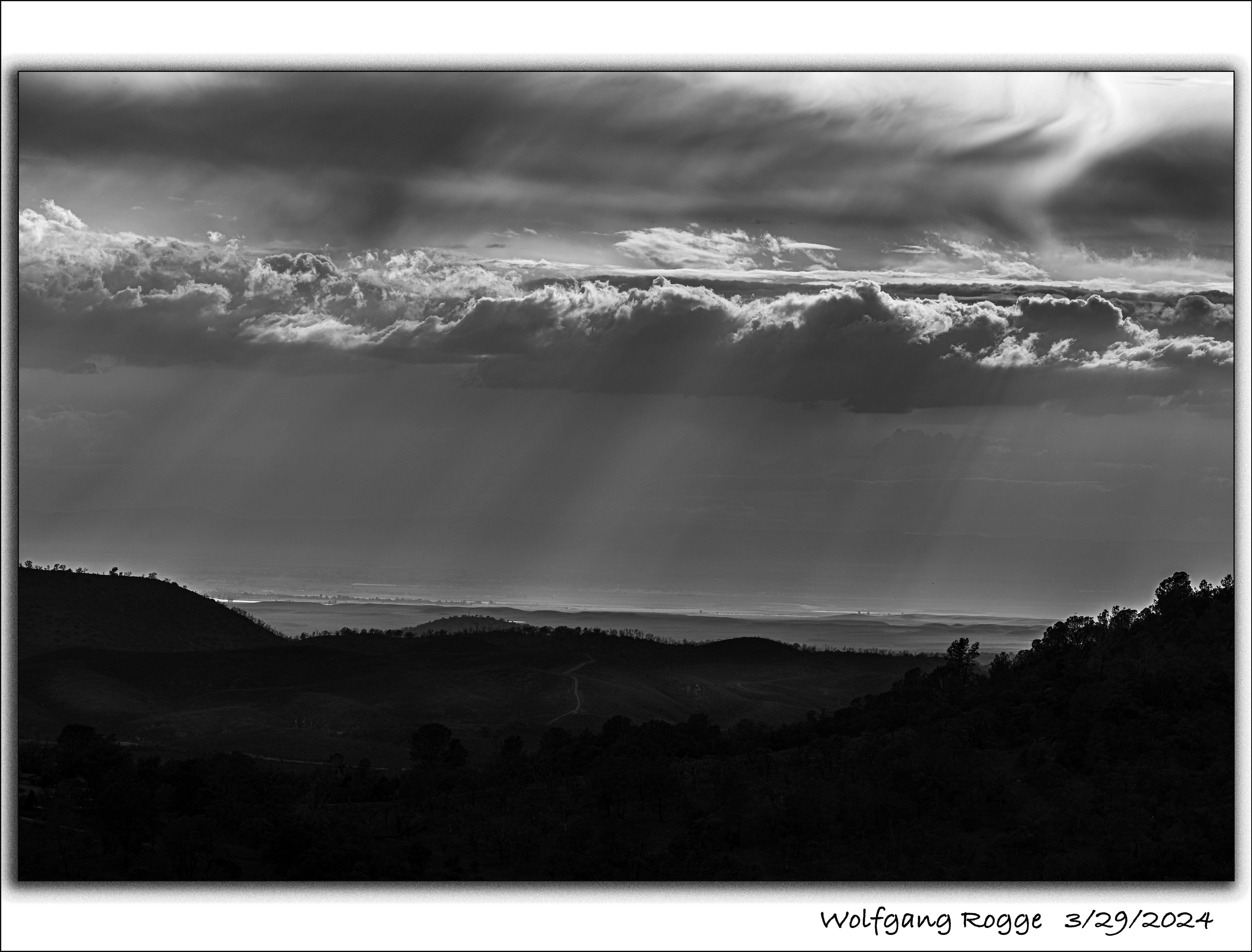
Living up on 1000+ Meters, at times I observe dramatic views down into the Valley.
…
..
.
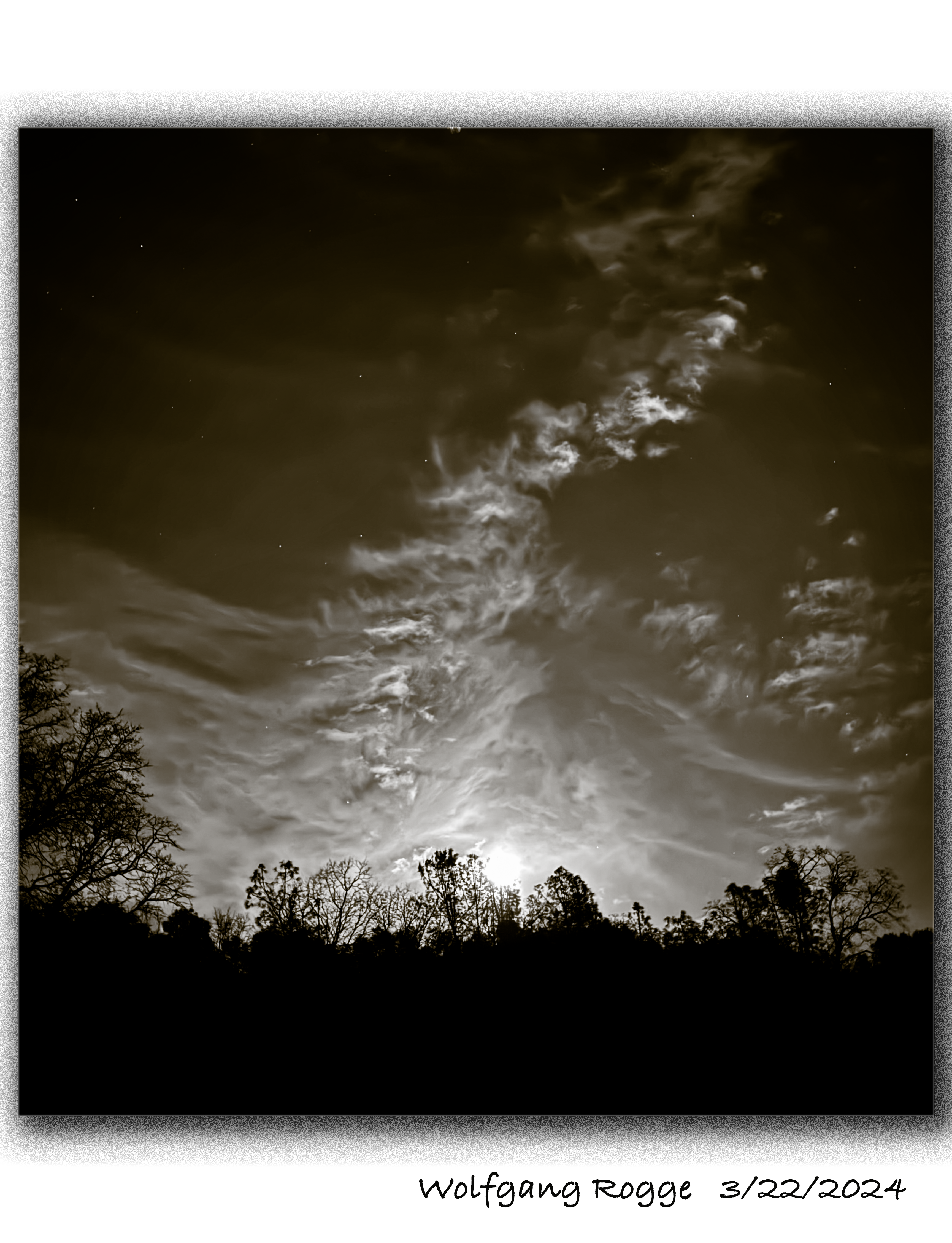
The moon is rising
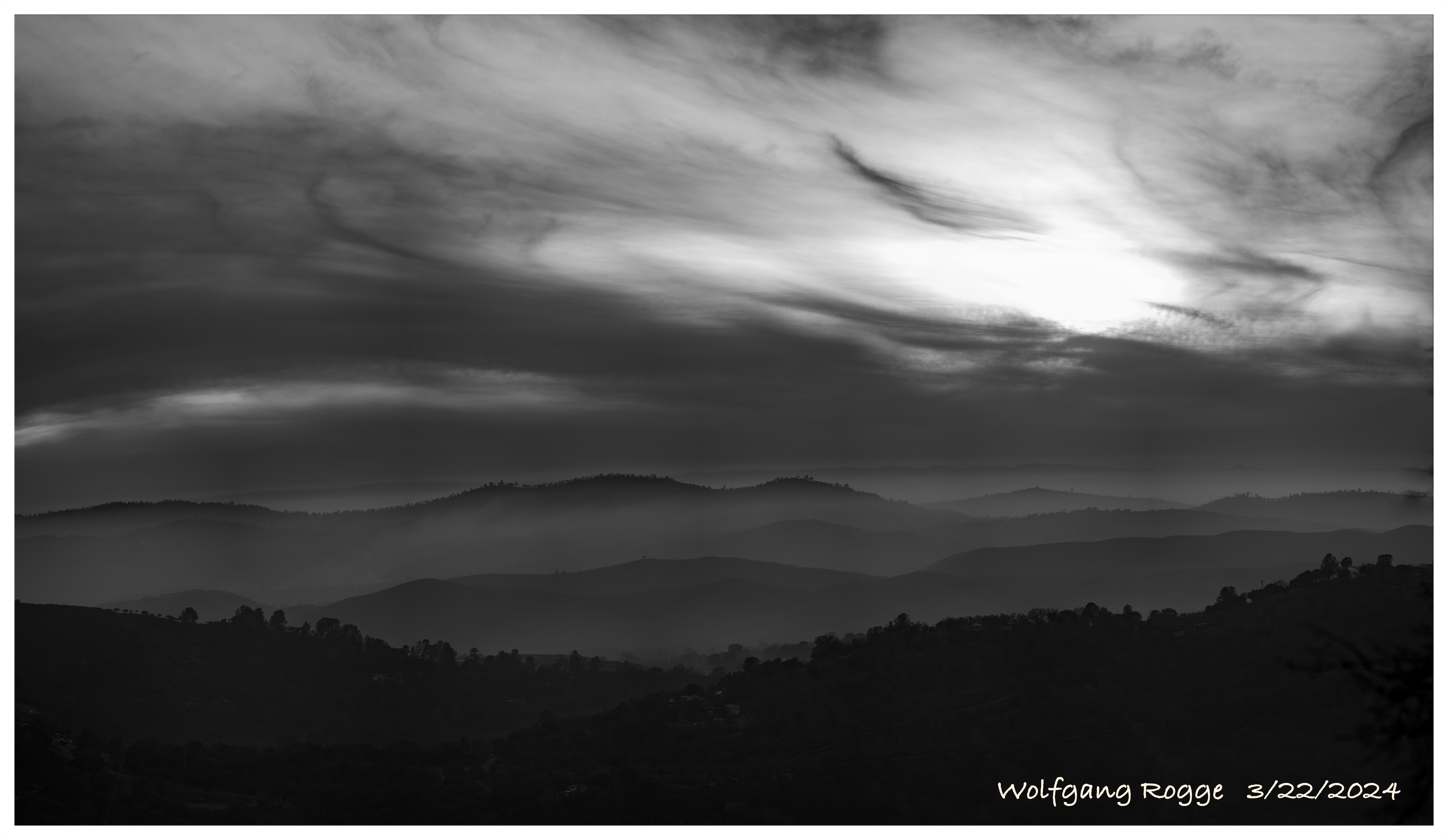
Clouds fight the Sun
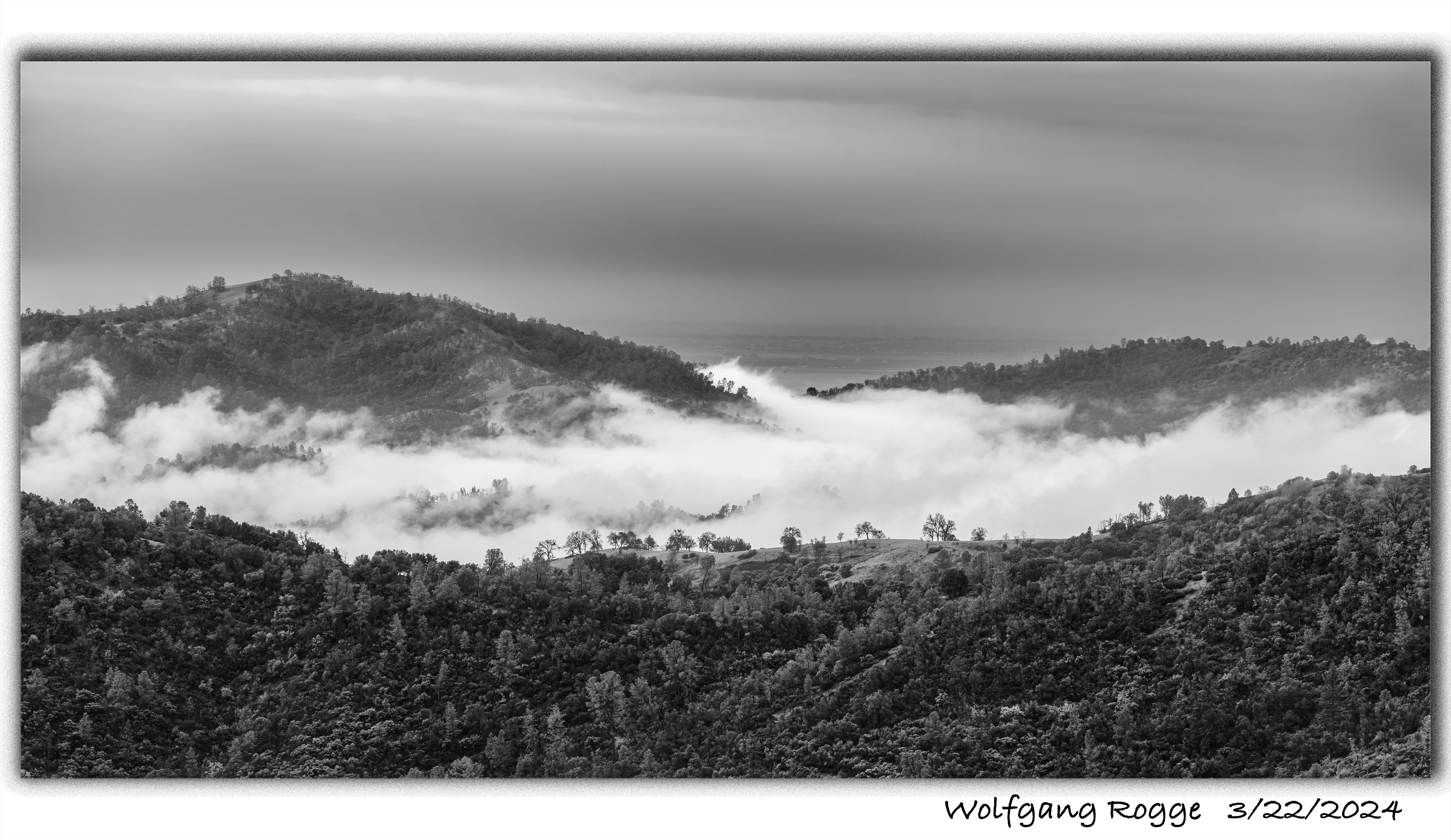
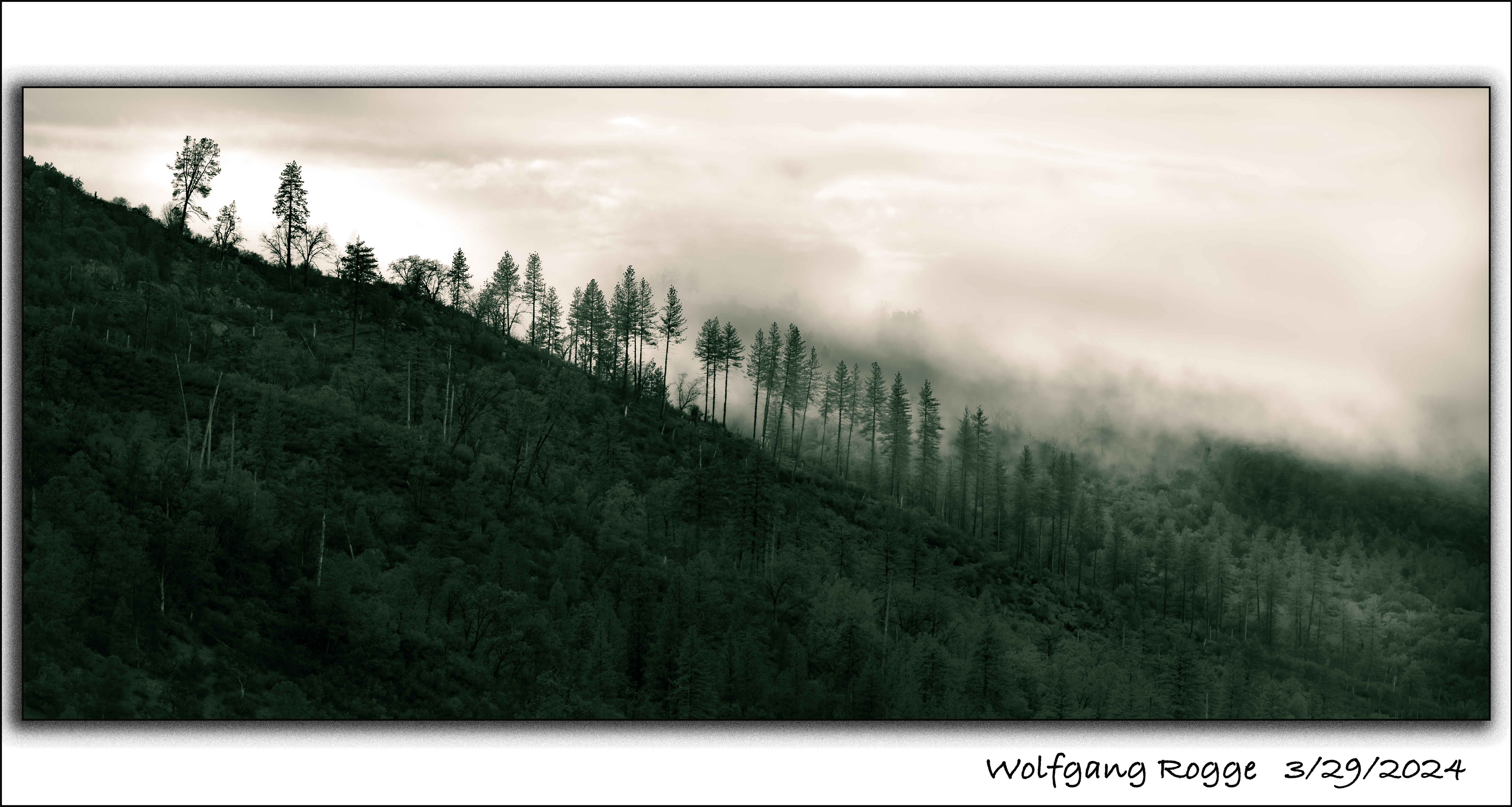
Early morning Fog
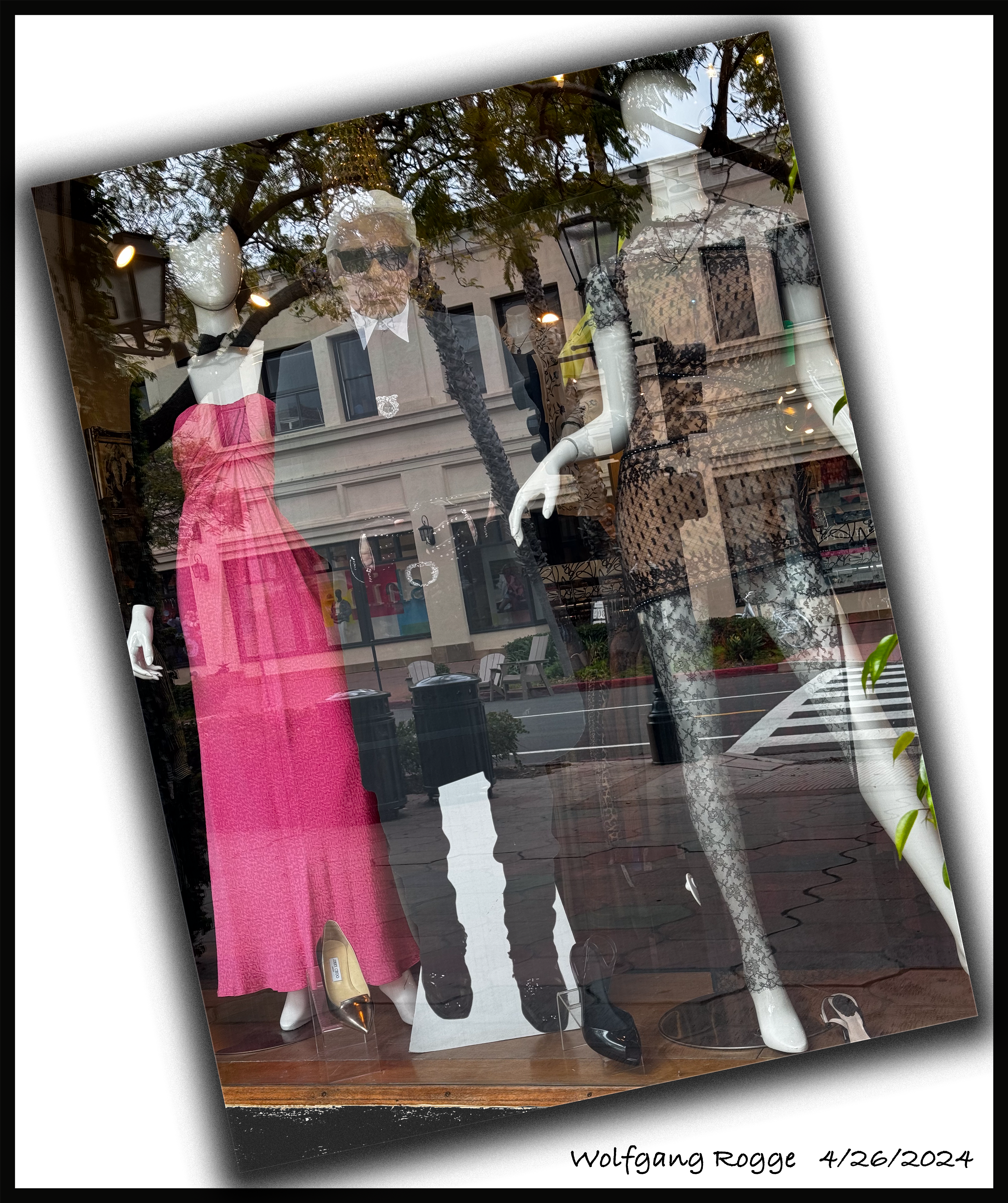
Looking through the window, thrown into the past!… Als ich durch das Schaufenster schaute, sah ich die Zeit rückwärts gedreht…

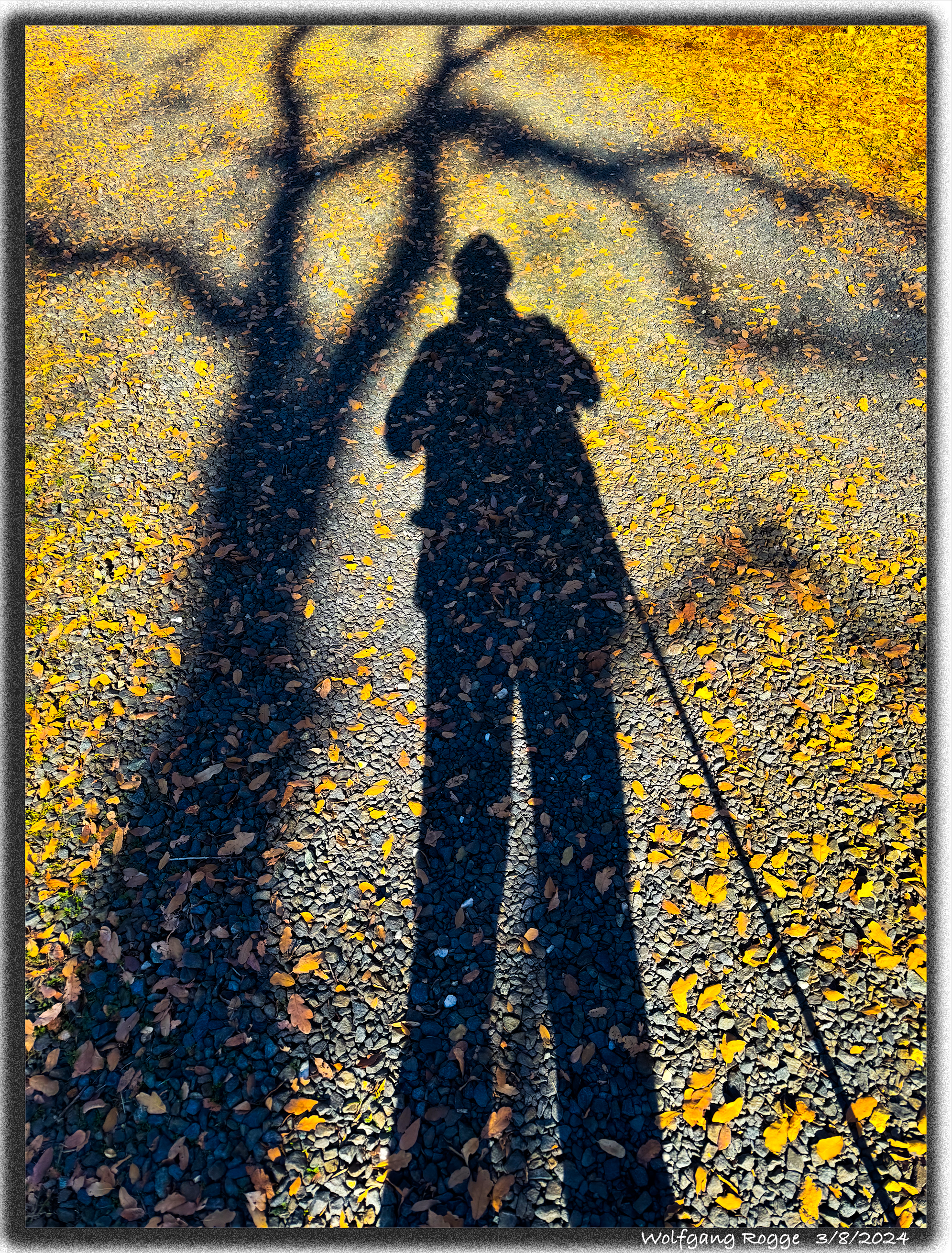
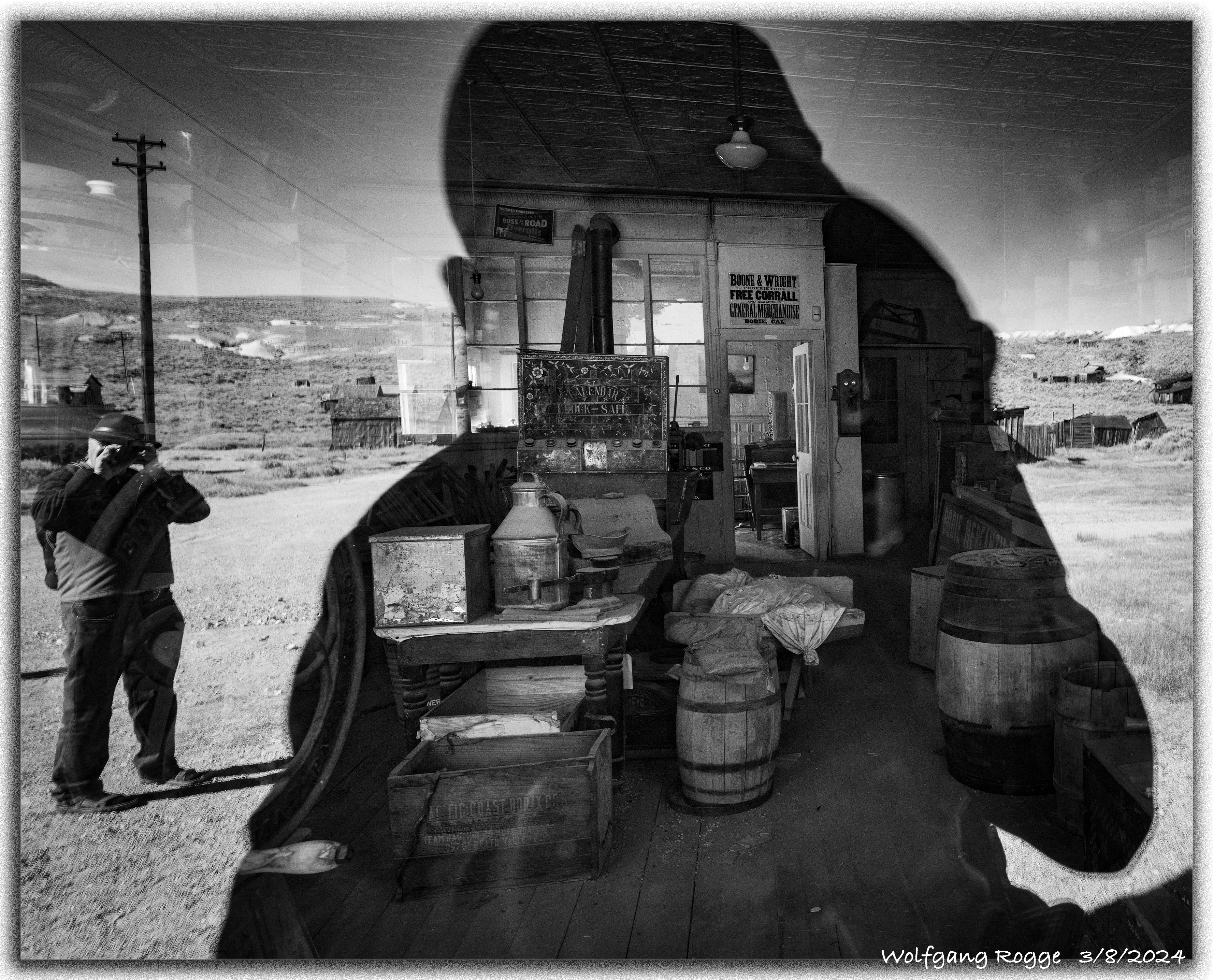
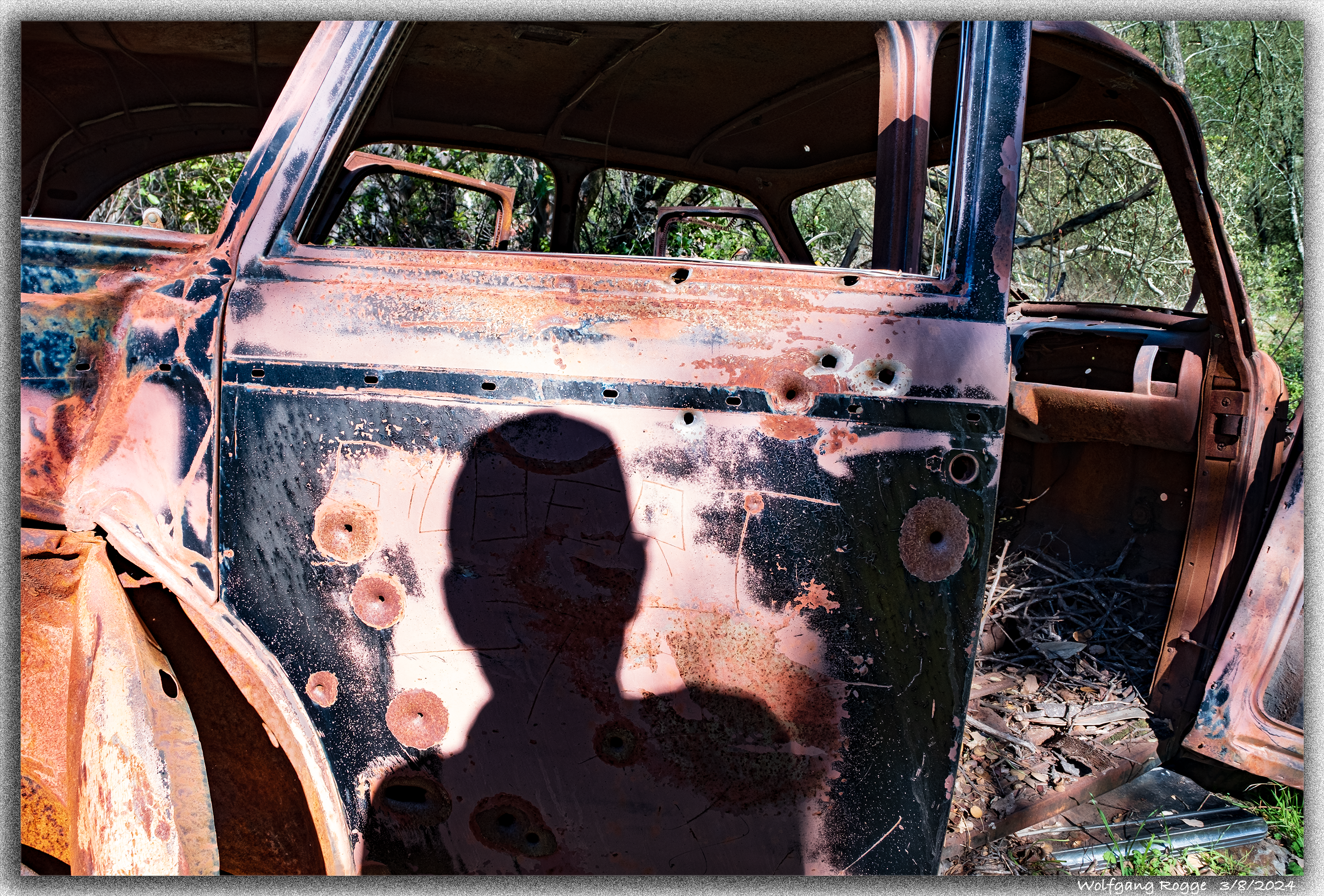
Photos purposefully using shadows, literally or implied, allow to make up a bunch of stories:
2. Only through the Shadow can you see… Sunlight being reflected by a window, becoming part of the photo, except where my shadow opens a path through the window and depicts the interior of the room. The photo was taken in Bodie, the ghost town. Gunslinger Fred is taking aim…
3. After the Shoot-Out, only the Shadow of past memories appear….
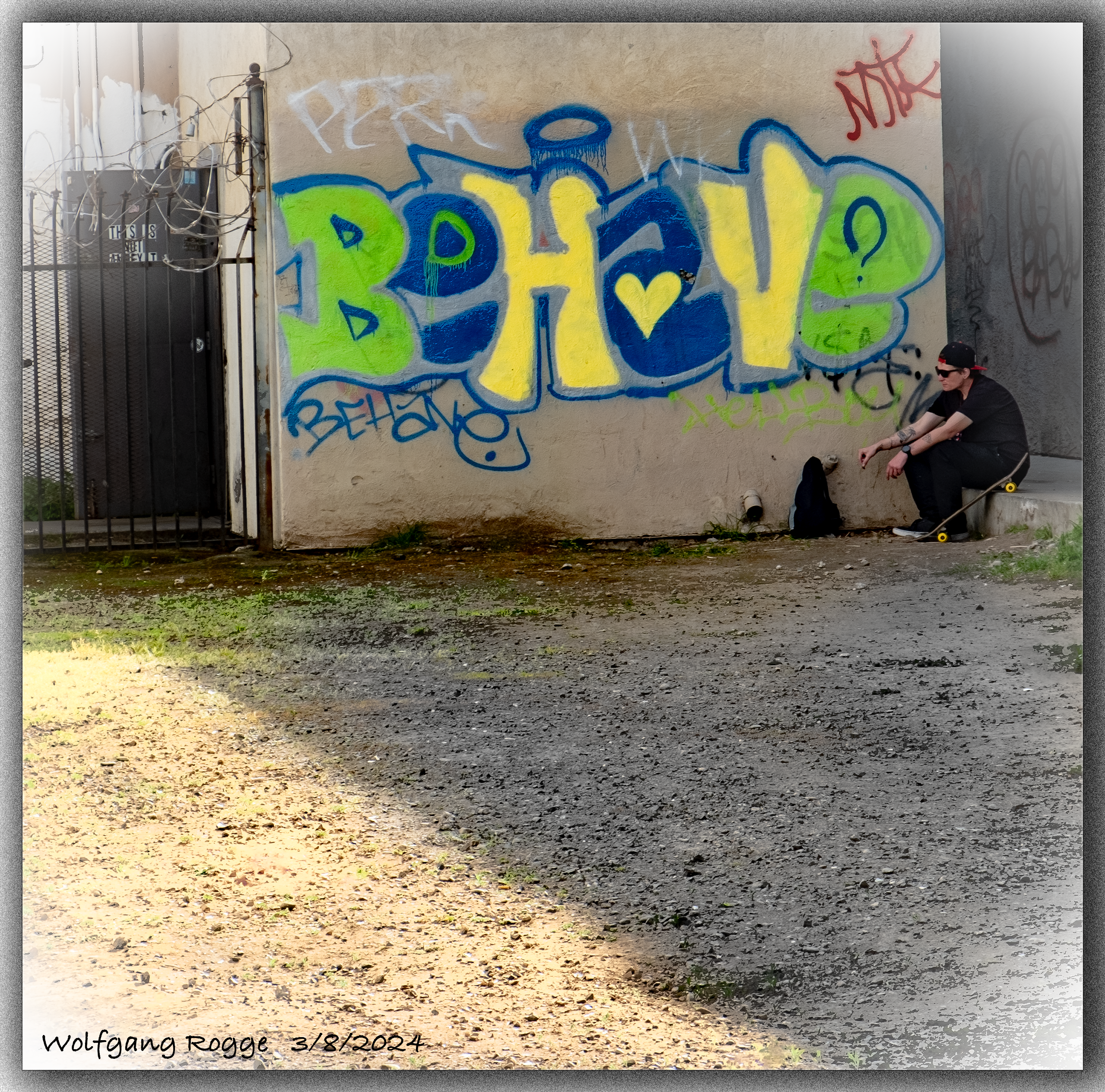
4. Living in the Shadows … “Behave” and accept your destiny in a marginalizing society where BORN RICH and HAVING is EVERYTHING.
Das San Joaquin Valley ist weltweit der größte Erzeuger von Mandeln und somit die Basis des lebensnotwendige Marzipans! I love Marzipan…
Who does not love Marzipan Pigs, Marzipan Stollen, Marzipan Kuchen, Marzipan Poppyseed Cheesecake? And then there is also Mazapan, a Latin American speciality containing peanuts and almonds. Almonds make farmers rich, an annual 6 Billion Dollar Business in California. By the same token, Almond Trees are extremely water thirsty. A little Almond Tree easily pulls 30 gallons (120 Liter) per hour out of the ground during a hot summer day. Now, think 2 million Almond Trees….. On the other hand, the US Geological Survey reports continued land subsidence (sinking land) due to over pumping of ground water. Since 1920, in some parts, land has been sinking down up to 100 feet (30 Meter). Could the loss of ground water be replenished and the land be lifted back up again? Unfortunately, not. Simply, between layers of ground water strata there are horizontal layers of clay which act as watertight barriers, essentially “swimming on top” of the ground water strata. Deep well pumping of water causes such clay layers to collapse, reducing, as a result, the capacity to store ground water even if a lot of water could be available in the future to replenish prior excessive over pumping. Sinking land causes infrastructure damage. For example, sewer typically is transported by gravity flow from homes to the sewer treatment plant. Unfortunately, if land sinks, sewer has then to be pumped, needing a completely new and more expensive pipeline system. Anyway, a little less “Almond Crazy” could go a long way. Still, I loves Almonds.
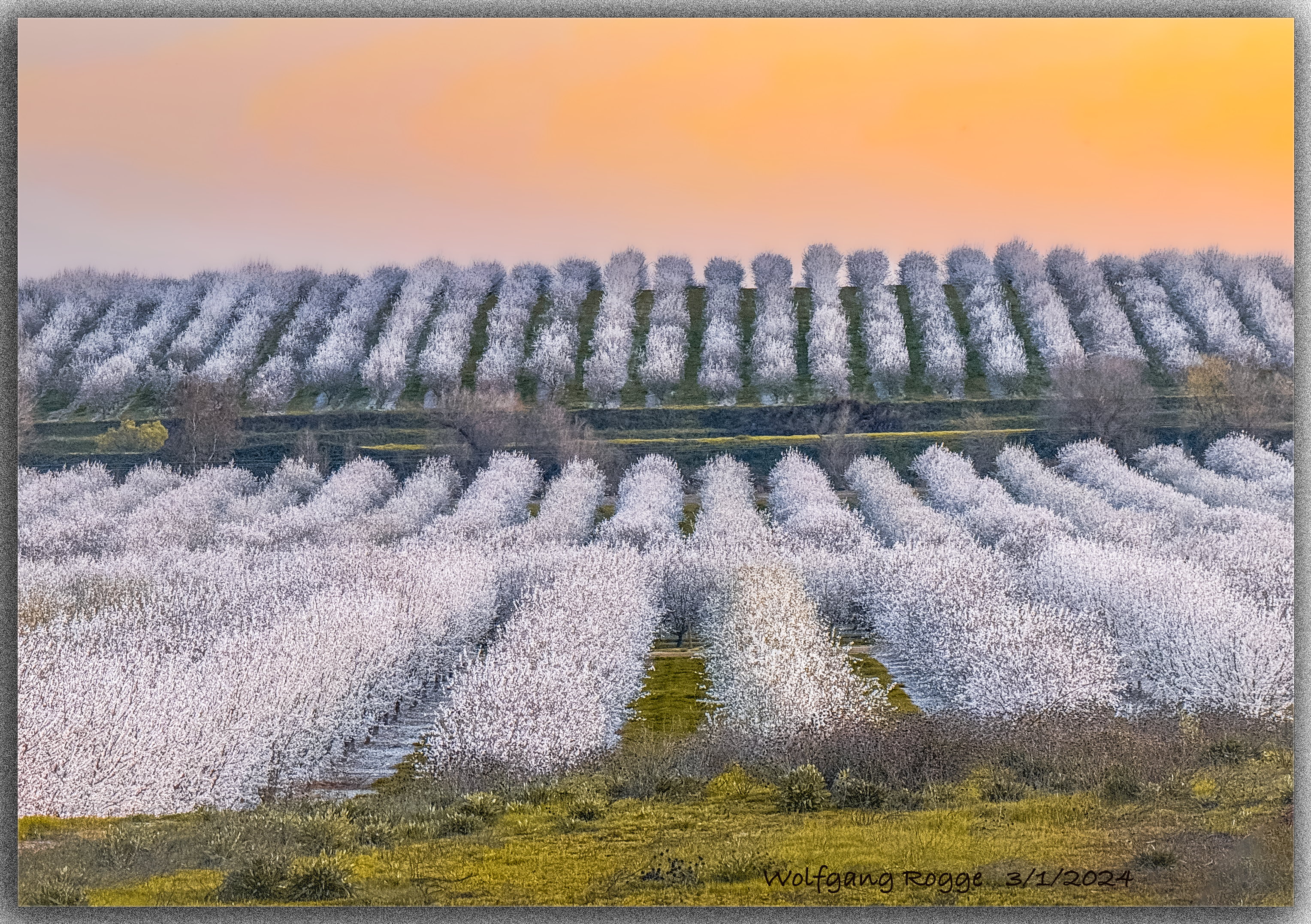
Currently, the Almonds are blooming. Here, my first Almond Blossoms.

Going far and wide in search for a little hill to pop up in the otherwise flat San Joaquin Valley to generate the lovely Almond Orchard photo. Enjoy!
Already last week, I shared pictures of a barn located along Highway 33 in Dos Palos. Driving onwards for another 50 miles or so along Highway 33 or using the old name Route 33 you come to Coalinga, located today in the western part of Fresno County.
By the way, just north of Coalinga, where Route 33 and Route 198 cross (Marker 333), the legendary bandit Joaquin Murrieta was killed in 1853 in Mariposa County. Yes, Mariposa County with all the Gold mines became the first county that reached West through the San Joaquin Valley and South, including present day Los Angeles. Mariposa county comprised originally 20% of California. In later years, it was broken up into 12 counties. Hence, also called “The Mother of Counties”.
Joaquin Murrieta, was also called the Robin Hood of the West or the Robin Hood of El Dorado. The novel “The life and adventures of Joaquin Murrieta by John Rollin Ridge (1854) is one of several novels that focus in one way or another on Joaquin Murrieta. The story goes that he was a forty-niner, a gold miner, originally from Sonora. Peace loving, he was driven to revenge after his brother and he were falsely accused of stealing a mule. His brother was hanged and Murrieta was horse-whipped. His young wife was raped, and some say that she died in his arms. Swearing revenge, he hunted down the Anglo tormentors. Apparently, he also stopped some gold loaded wagon to lift off the precious belongings. The State of California offered a reward of $5,000 for Murrieta, “dead or alive”. Reportedly, he was killed by a rancher at said junction, but myths arose about his possible survival. There are a good number of tales about him and his life. One of these days, I might investigate some more.
Coal was discovered in 1870 in the foothills of nearby Mount Diablo. The coal from several mines was taken by mule carts to three transfer locations, called Coaling Stations A, B, and C. In 1888, the Southern Pacific Railroad Company built a railroad serving those three Coaling Stations and transported the coal onwards to Alcalde in the Warthan Canyon, where then coal wagons were further on transported to Southern Pacific Railroad locations and used to power their steam locomotives. Eventually, a town developed around Coaling Station A, and for short, the name morphed from Coaling-A into “Coalinga”, which became an official town in 1906.
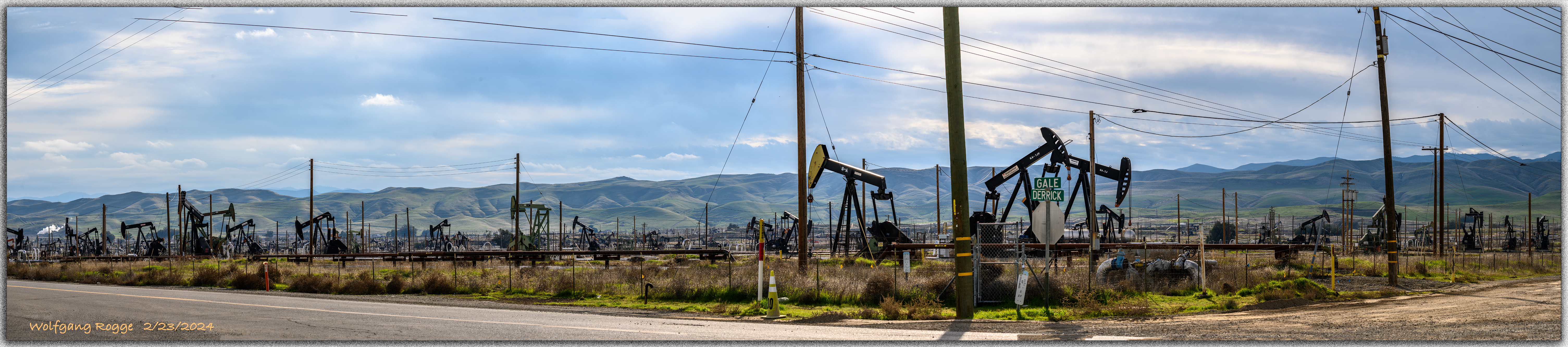
In 1909, rich oil fields around Coalinga were discovered, the coal mining quickly came to an end. The Rich Oil fields are still being pumped until the present days.
In Coalinga, a wooden pumping jack is displayed, similar to the one shown below, but not as pretty. Anyway, the pumping jack in town operated from 1918 until 1979 and had an overall lifetime production of 275,000 barrels of oil.
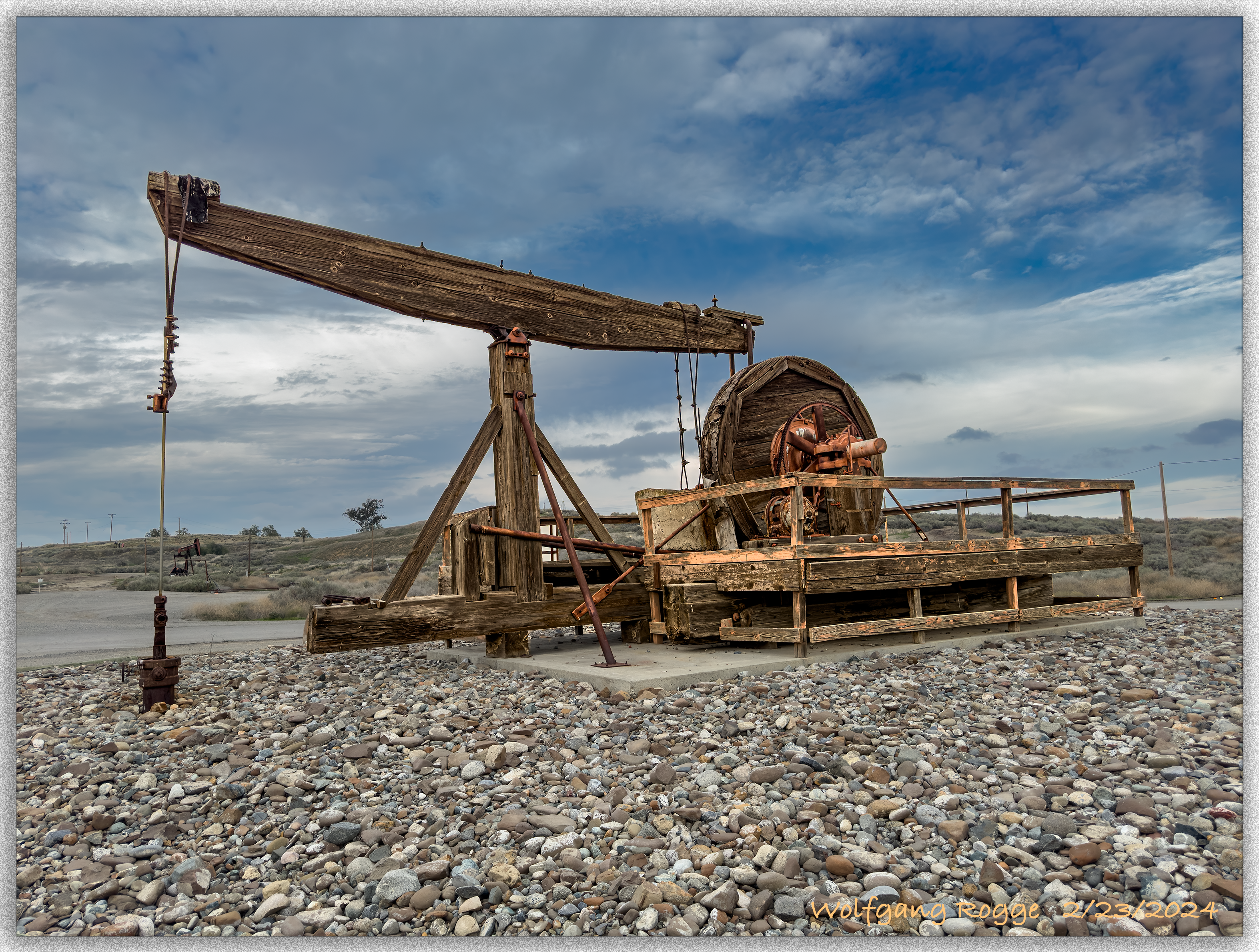
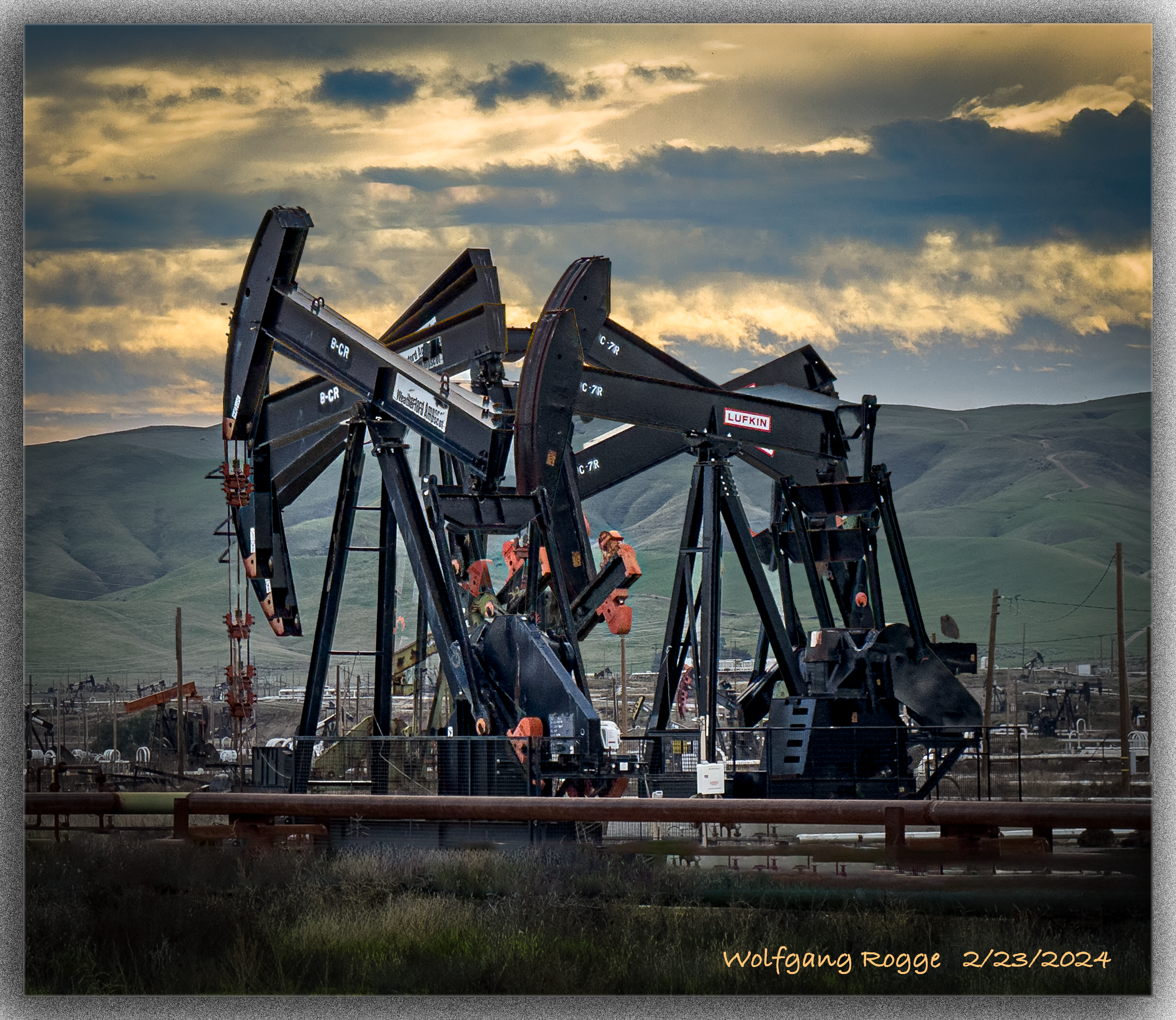
Today, modern pumping jacks are many times larger than the wooden one shown above, having about 20 strokes per minute with volumes ranging from 1-10 gallons per stroke, or up to about 5 barrels per minute. Below, pumping jacks in motion of an extended oil field with most likely hundreds of pumping jacks, just a few miles north of Coalinga.
By the way, Coalinga had horribly contaminated ground water. Hence, water had to be transported into town from farther away, until the invention of reverse osmosis lead to a water purification plant in Coalinga. Another noteworthy environmental issue was a large asbestos mine in the foothills, that become eventually an EPA superfund site. Essentially, that means that the prior owners run off or “sold” the industry to somebody who essentially was close to be bankrupted … and then the tax payer had to pay for the clean up. A frequent approach in many nations on how to handle industrial pollution.
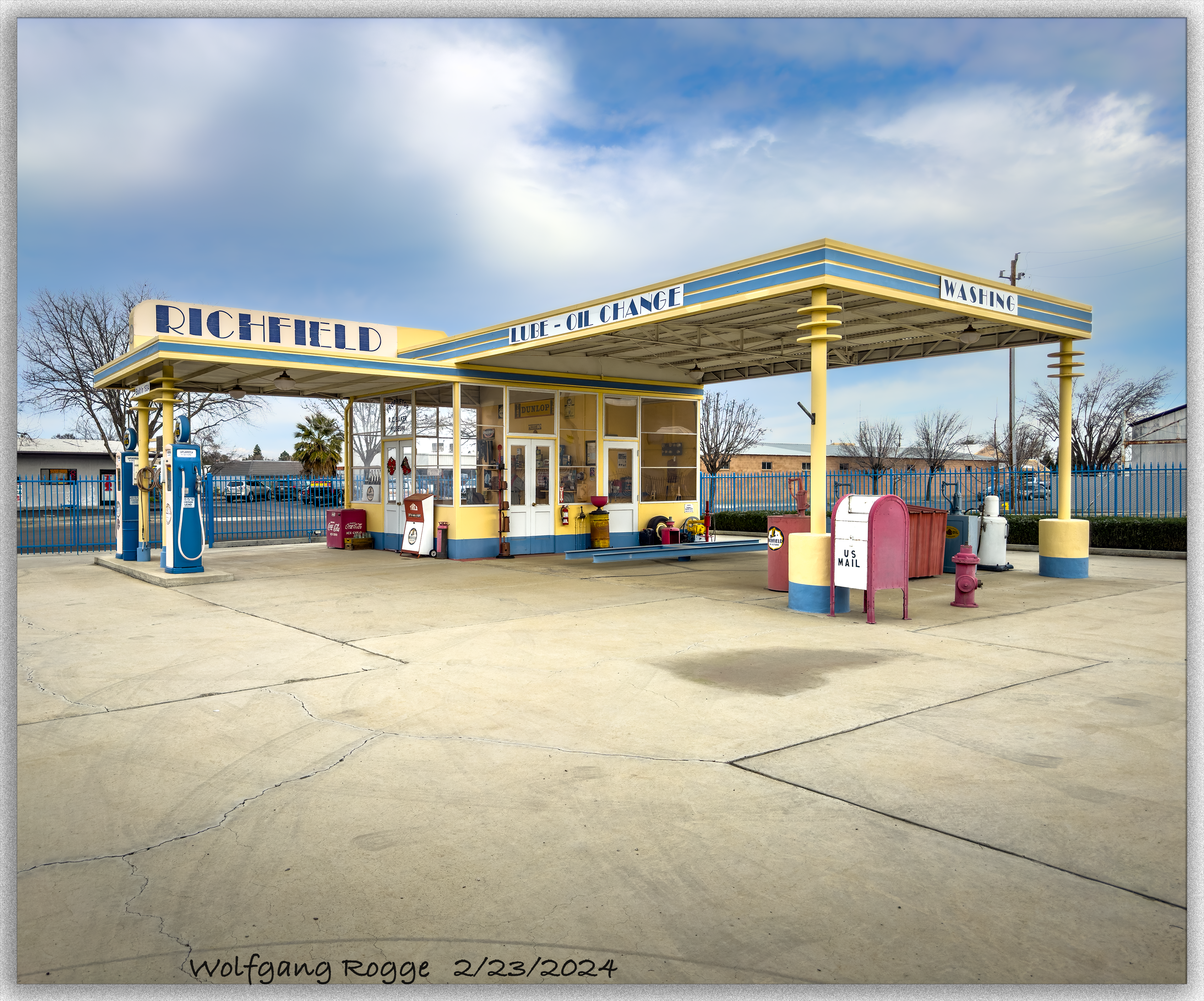
In town, there is also the R.C. Baker museum, depicting the coal, oil, and also other mining industries in the nearby land. It is apparently open from noon to about 5pm on Saturday and Sunday. The museum also harbors a 1934 Gas Station shown below.
In the good old days, a gallon of regular was just 14.9 cents.
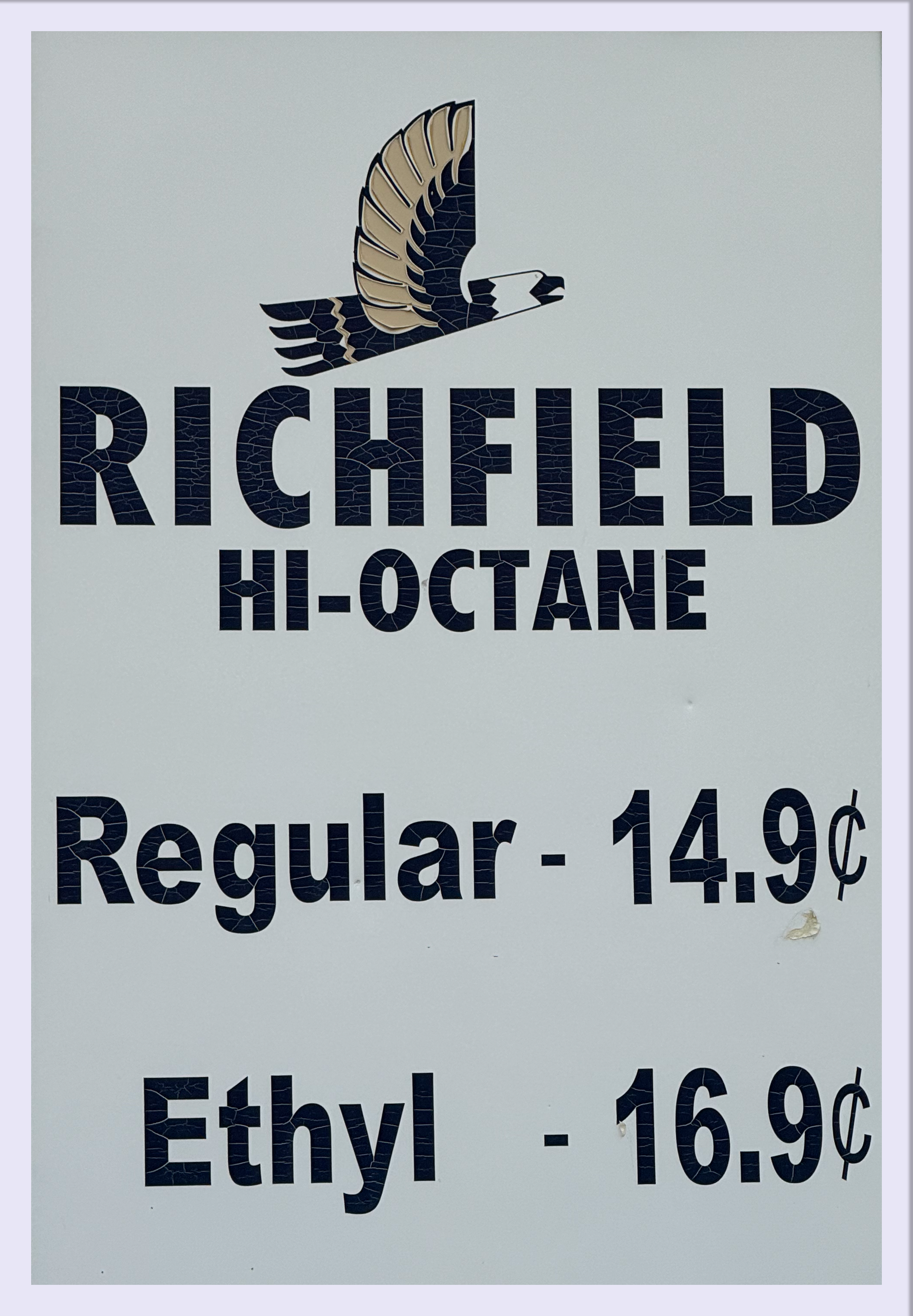
The “Richfield” Gas Station next to the museum, from the days when driving a gas guzzler was real smoking fun…. 🙂